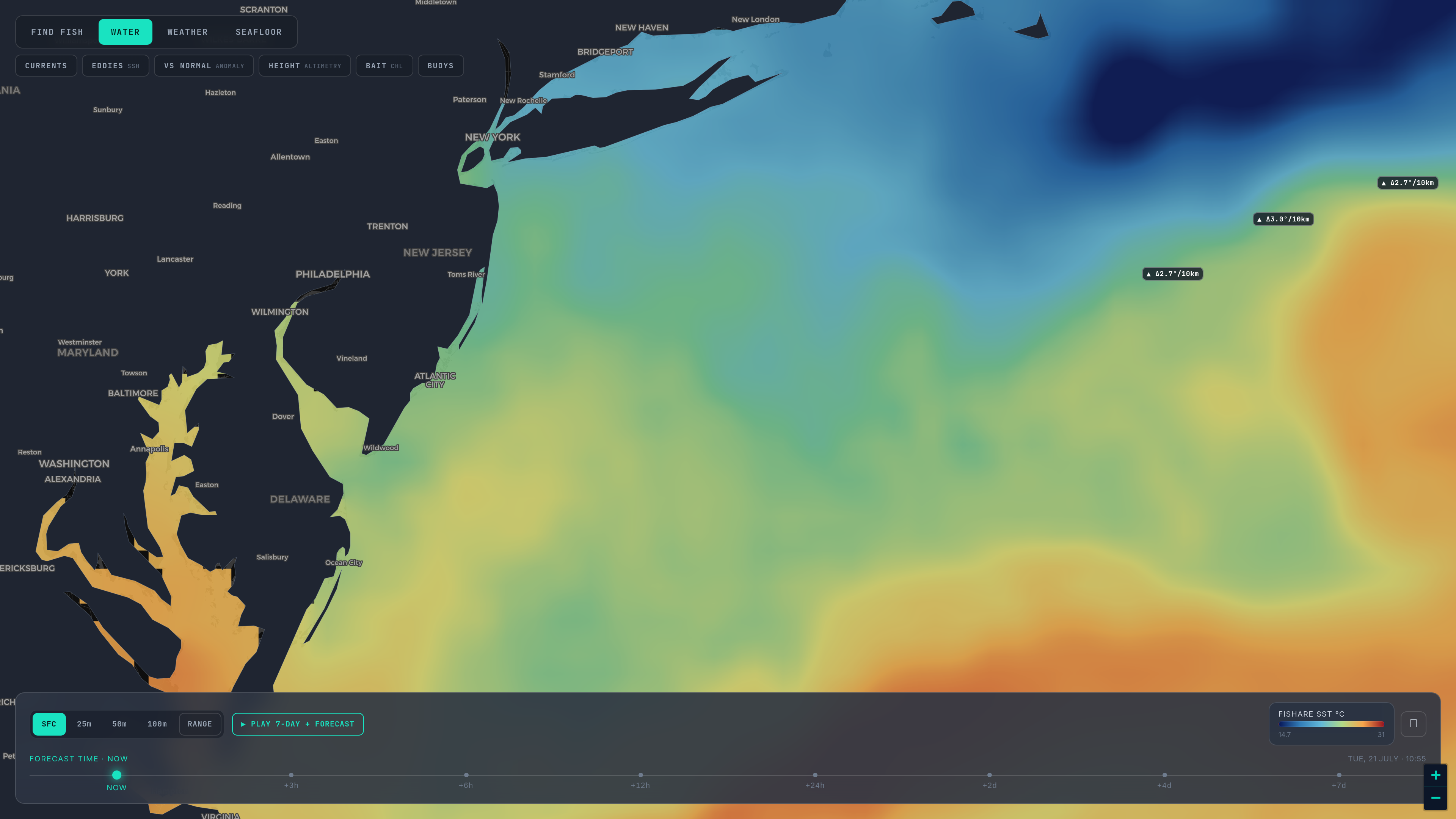
A temperature break is a place where the sea changes its mind. Bait and the things that eat bait collect where it does.
Part 2 of six. Each tip ends with a tag such as sst_break_definitionA: the rule it rests on and that rule's confidence grade (A agency or peer-reviewed, B two or more practitioners agree, C one practitioner or anecdote, I a property of our own bake). Tap a tag to read the rule and its sources. The worked read is from the Sydney composite and keeps its degrees C and kilometres.
A break, or front, is where two water masses meet: warm against cool, clear against green. They do not mix quickly. They touch along a line, and along that line the seam concentrates plankton, drifting debris and bait, and the pelagic predators patrol it instead of searching open water. Temperature is not the cause of any of this. It is the part of it a satellite can see. sst_break_definitionA
That is also why a break is not a promise. A line on a chart is where the conditions that concentrate bait can occur. It says nothing about whether the bait or the fish are there today. We say where the water says to look, never where the fish are. honest_hedge_languageI
So how do you tell a break worth a tank of fuel from a colour step on a screen? Five checks.
1. Strength
How big is the step? The step is the first thing experienced readers look at. Half a degree is the trade's floor, a degree or more is what longliners want, and two or three degrees across a few miles is a wall; but in flat water, the tropics or a SoCal summer, a fraction of a degree can still be the best feature in that field. sst_break_strength_scales_with_deltaB The label gives you both temperatures. Compare them with your species' window for your ocean: when the fish's preferred water is on one side only, the line is a wall they run along, not across. temp_window_species_contextB sst_break_fish_run_along_not_acrossB
2. Persistence
Does it show on the next pass, and the one after? Experienced crews give a break about three days to set up, because plankton, then bait, then predators take days to assemble on a new boundary; a line that has held three to five days is at its best. sst_break_persistence_three_daysB The Pass Read, our three-day satellite read for Sydney, the New Jersey canyons and San Diego, only calls a break when the same line holds on at least two passes. A line on one pass is a lead.
3. Depth
Is it a surface effect or a water-mass boundary? A flat, sunny afternoon paints edges on the top layer that are gone by dawn. hourly_morning_edgeA Drop the same field to 50 metres: a current edge or an eddy rim reaches tens to hundreds of metres down, and a surface artefact dissolves. subsurface_confirms_break_depthB The six depths, 25 to 200 metres, are a daily model, each checked against Argo float profiles, so read them as a comparison between levels rather than a measured number: agreement supports the break, disagreement is a caution, neither is proof.
4. Colour
Is there a chlorophyll edge on the same line? Blue water against green water along the break is a stronger case than temperature alone: a boundary that changed the food as well as the heat. chl_with_temp_break_stacksB Part 5 covers how to read it. In the Pass Read it counts as an edge when one side holds at least one and a half times the chlorophyll of the other.
5. Height
Is the sea surface higher on one side? Altimetry sees the dynamics beneath the skin and persists for weeks, so a break with a height gradient under it is a real water-mass boundary rather than surface heating or a cloud artefact. It is coarse and days old, though: it confirms, it does not position. ssh_confirms_sstB Tight height contours mean current, and where a current crosses a thermal line the water converges and the bait is pinned. ssh_gradient_is_currentB
The more of those a break passes, the stronger the case; one that passes only the first is worth a look on the way past. Structure moves it up the list again: a break over the shelf edge, a canyon head or a bank concentrates the ecosystem twice over. sst_break_over_structureB
A worked read
On 19 October 2026 the 72-hour composite off Sydney held a 21.5 °C edge: a 1.5 °C step from 20.0 °C, 35 kilometres long, warm side to the east-south-east, over the shelf edge about 28 kilometres east of Long Reef and 25 kilometres north of Browns Mountain. sst_break_definitionA sst_break_over_structureB Strength: a modest step, but 21.5 °C sits at the floor of the striped marlin band for this coast and inside the kingfish band, with yellowfin water on the cool side, so it is a line fish would run along rather than across. temp_window_species_contextB sst_break_fish_run_along_not_acrossB Height: the day's eddy atlas put a warm eddy 43 kilometres across centred 60 kilometres east of Sydney, and the edge lay on its inshore rim, which is the part of a warm eddy worth fishing. warm_eddy_edge_fish_perimeterA ssh_confirms_sstB Persistence, depth and colour were not run for that read, and the composite folded 27 hours of passes into one picture, so that is where it stops: a break worth a closer look on the next clear pass, not a certainty. composite_vs_passB honest_hedge_languageI
What changes when you can see the break drawn
Reading a break by eye is a skill, and it is easy to find the one you were already hoping for. Drawing it with the same detector on every pass, with the same 0.45 degree gate and the same five kilometres from cloud, takes the hope out of it. sst_break_definitionA cloud_hole_is_missing_not_edgeI You still make the call, and you still confirm it: watch the transducer as you run in and expect the seam a few miles from where the pass drew it. sst_break_verify_on_boardB
Next: Part 3 — The cloud-free composite versus a single pass. Back: Part 1. The habitat score that sits on top of all this is explained at how the model works, and every rule tagged above is on How we read SST.
Open the map and tap a labelled break to read its two temperatures. The switching guide is for anyone comparing this with a per-region chart service.