PASS READ · VENICE, LOUISIANA · NOV 10–NOV 13

Venice, Louisiana SST: The 74 °F break held its line

Every satellite sea-surface-temperature pass over the delta rigs, the Loop Current edge and its eddies in the 72 hours of Nov 10–Nov 13, read in order. A new read every three days.

Open this water on the live SST mapFishare for iPhone

THE READ · POSTED 13 NOVEMBER 2026

What the passes show

Passes read
22
The break
74 °F
Step across it
7.0 °F
Seen on
14 of 22 passes
Movement
held its line
72-hour composite
99% of the water clear

22 passes over the water, in order, clouds left as holes (MetOp-B AVHRR, MetOp-C AVHRR, NOAA-21 VIIRS, NOAA-20 VIIRS).

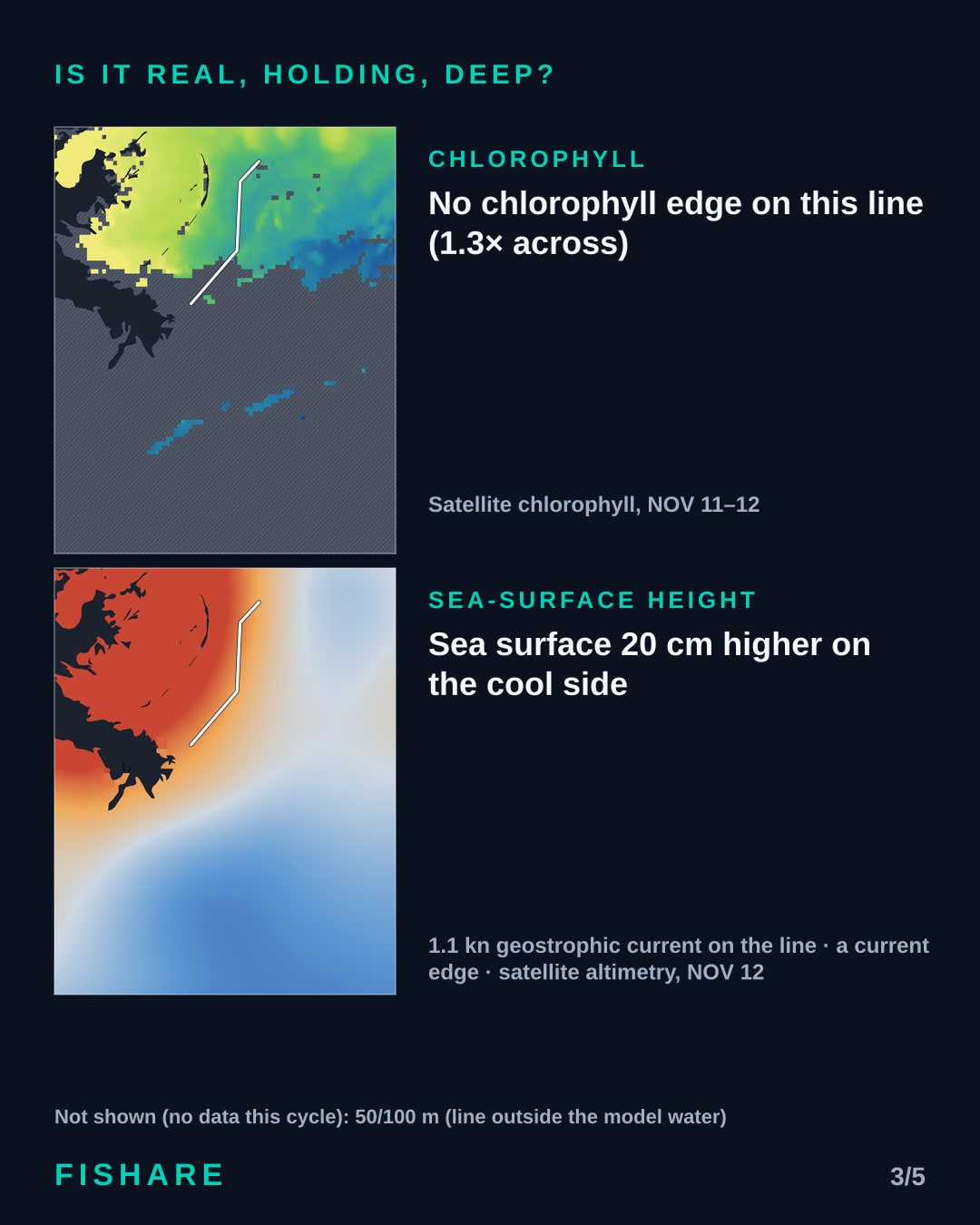
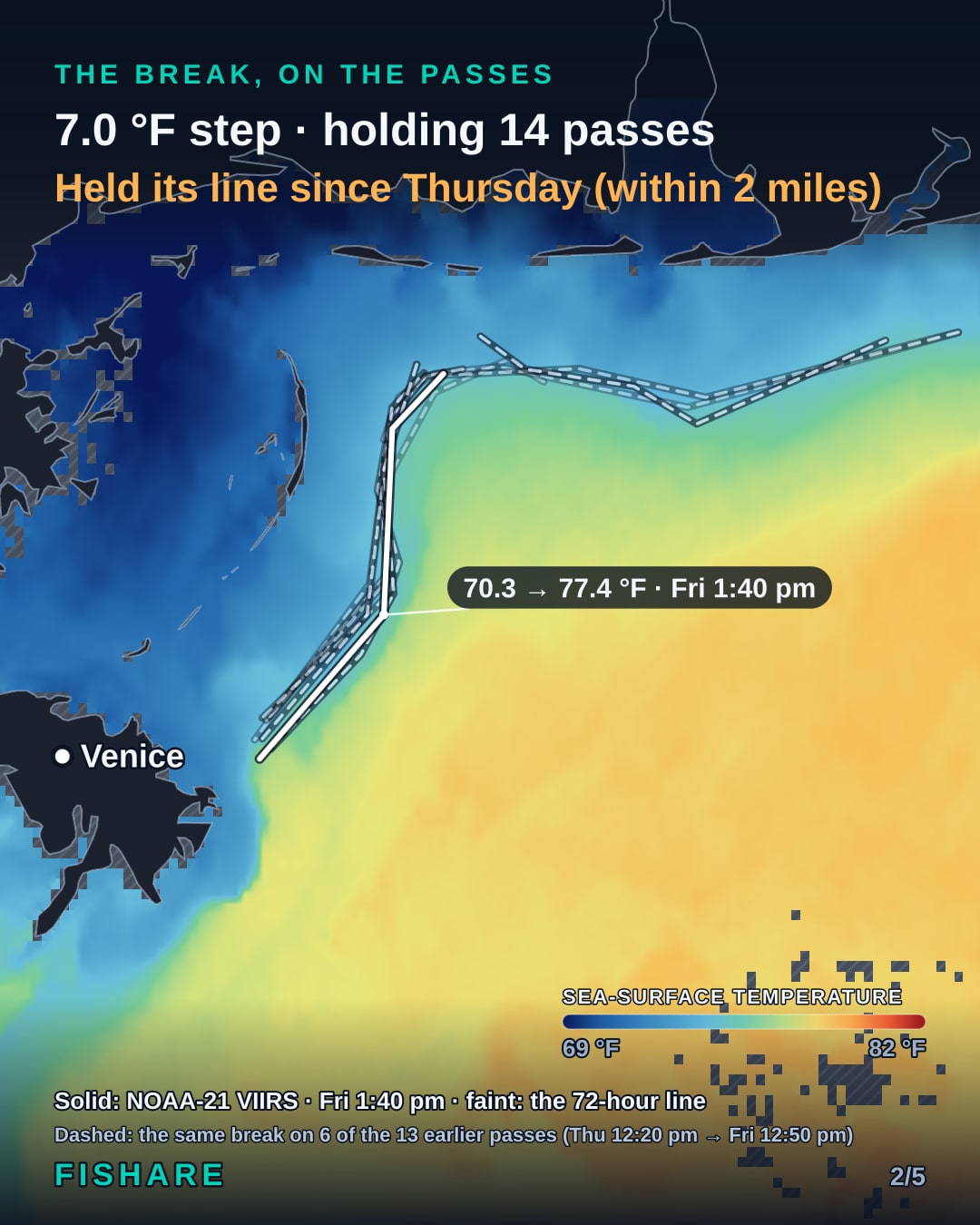
The 74 °F break: a 7.0 °F step across it, seen on 14 of 22 passes. It held its line since Thursday.

No chlorophyll edge on this line (1.3× across). Sea surface 20 cm higher on the cool side, 1.1 kn geostrophic current on the line — a current edge.

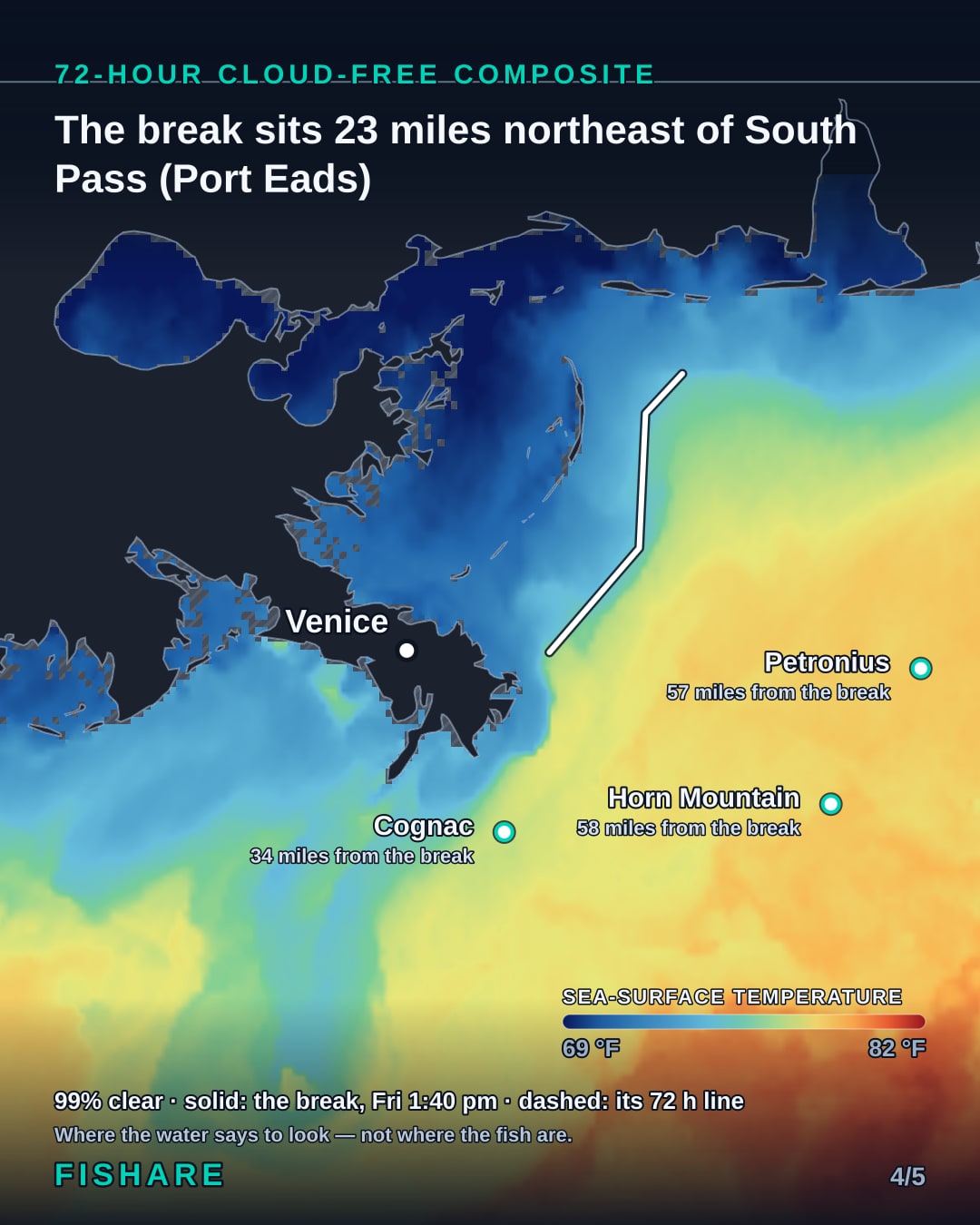
The break sits 23 miles northeast of South Pass (Port Eads).

Every number is from the satellite passes. Where the water says to look — not where the fish are.
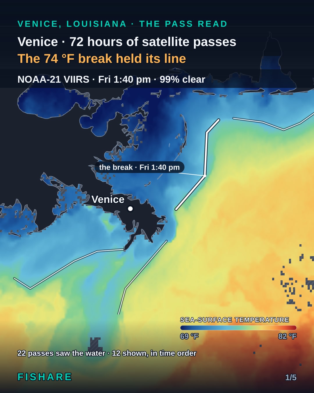
Every satellite SST pass over Venice, Louisiana in the 72 hours of Nov 10–Nov 13, in order
The pass that saw the most of the water off Venice, Louisiana, Nov 10–Nov 13
What sits under and beside the line: chlorophyll, the water at depth and sea-surface height off Venice, Louisiana
The 72-hour cloud-free SST composite off Venice, Louisiana, Nov 10–Nov 13

Watch this read as a 60-second video

Every read of this water is also posted as a 60-second video on YouTube, Instagram and Facebook. Follow the series there:

YouTubeInstagramFacebook

THE GROUNDS · NOV 10–NOV 13

Water temperature at the grounds

Sea-surface temperature at each ground in season off Venice, Louisiana, on the 72-hour satellite composite of Nov 10–Nov 13: the mean of the clear water within 4 miles of the ground’s charted position. The last column is how far the break sits from it.

GroundSea-surface temperatureFrom the break
Cognac76.8 °F34 miles
Petronius78.1 °F57 miles
Horn Mountain78.0 °F58 miles
The Midnight Lump74.9 °F58 miles
Na Kika77.7 °F64 miles
Medusa76.0 °F69 miles
Appomattox78.1 °F77 miles
Mars77.2 °F78 miles
Thunder Horse79.4 °F79 miles
Lobster76.9 °F112 miles
Neptune78.0 °F145 miles
Atlantis78.0 °F158 miles
Holstein80.2 °F167 miles

A satellite reads the surface of the water, not the water at depth.

HOW TO READ IT

A pass, a break, a composite

A pass is one satellite crossing the water once: it sees what the cloud lets it see and leaves the rest as holes. A break is a line the temperature steps across, and it only counts when more than one pass saw it. The composite fills the holes from the other passes of the same 72 hours.

How to read an SST passWhy fish sit on a breakComposite or single pass

One Fishare Pro subscription covers all 15 regions. The bite score, tides and wind are free. Open Venice, Louisiana on the map.

Friday Edit · one email a week

The Friday read for your water

Four regional editions, one email each Friday morning: the week’s forecast, what is running, and the Pass Read for your water, the satellite sea-surface picture with the break marked.

Free. Unsubscribe in one click, always. Every email has a link to switch edition.

OTHER WATERS

SydneyNew Jersey canyonsSan DiegoAucklandAll Pass Reads

SOURCES

Satellite SST: NOAA/STAR ACSPO L3U via NASA PO.DAAC (subskin temperature)

Chlorophyll: NASA OB.DAAC VIIRS

Sea height: Copernicus Marine DUACS altimetry

Coastline: Made with Natural Earth

Every data source and licence