
Every fishable corner of Port Jackson — Watsons Bay to Roseville Bridge, the Heads to the inner Bridge. Where the metre-plus kingfish hold inside the Heads, where the squid jigs come out (and the four reserves where they don't), the dioxin line that splits the harbour at the Bridge, and the platforms where the lifejacket law actually applies.
Port Jackson is one of the busiest working ports on the east coast, the front yard for five million people, and it still produces metre-plus kingfish from rock platforms inside the Heads and 70 cm-plus mulloway off the Middle Harbour drop-offs. The fishery survives inside a tri-jurisdictional patchwork: NSW DPIRD handles fisheries rules, NSW National Parks and Wildlife Service controls the Sydney Harbour National Park foreshore, and the Sydney Harbour Federation Trust manages former defence land from Cockatoo Island out to North Head. Mosman, Northern Beaches, Woollahra and Hunters Hill councils run their own foreshore reserves on top.
The practical effect: you can stand on a rock platform inside North Harbour Aquatic Reserve, look across at a no-take sanctuary (Cabbage Tree Bay) a kilometre to the east, and out toward a state-wide protected species (Eastern Blue Groper) feeding visibly off the kelp. Fishing World's long-running estimate is that around 60 per cent of the harbour has some form of recreational fishing restriction once you stack aquatic reserves, intertidal protected areas, sanctuary zones, naval exclusion zones and the dioxin closure.
This guide is the practical walk-around: where you can fish, where you can't, what's on the bite each season, and the consumption advice once you do land something. Every regulatory claim is sourced from the NSW DPIRD 2024-25 Saltwater Fishing Guide and the relevant NPWS / Food Authority pages — all linked at the end. Always check current local signage before setting up.
Before anything else: Sydney Harbour is contaminated with historical dioxins from the Union Carbide / Allied Chemical works that operated at Homebush Bay from the 1940s through the 1980s. The contamination is most concentrated in the sediment west of the Sydney Harbour Bridge and works up the food chain into the fatty tissue of resident fish. NSW Health and the NSW Food Authority issue the consumption advice; the boundary is the Bridge.
Berry Island and a handful of other spots sit at the boundary line itself. When in doubt, catch and release. The full per-suburb breakdown is in the species chapter — see "What you can eat" below. NSW Food Authority: Sydney Harbour seafood; NSW Health: Dioxins fact sheet.
The inner harbour runs from the Sydney Harbour Bridge east to the Heads, and from the southern foreshore (Rose Bay, Vaucluse, Watsons Bay) across to the north shore (Mosman, Cremorne, Neutral Bay). It's mostly sheltered, mostly accessible by ferry, and almost all of it sits east of the dioxin boundary — so you can eat a fish under the 150 g per person per month NSW Food Authority limit, where west of the Bridge it's catch-and-release only.
The whole shoreline here is inside the Sydney Harbour Intertidal Protected Area (IPA). You can line-fish, but you cannot collect cunjevoi, oysters, pipis, crabs, mussels, octopus, urchins, anemones, snails or worms, alive or dead, from mean high water out to ten metres seaward of mean low water. That rule alone catches out a lot of visitors who think pumping nippers off Rose Bay flats is fine — it isn't. Bring bait from outside the harbour.
Camp Cove is the easy half of Watsons Bay — a calm netted-feel beach inside South Head, reachable by F9 ferry from Circular Quay then a five-minute walk. The rocky south point is one of the harbour's better land-based kingfish marks (Craig McGill of Fishabout describes it as offering the harbour's best shore access to quality kings). Squid and cuttlefish are present on the kelp at both ends of the beach.
The ferry wharf and the rocky edges south of the pilot station fish the same multi-species pattern as Camp Cove with more depth in front of you. Bream, trevally, flathead and luderick along the edges; salmon and tailor on metals in the cooler months; deep drop-offs near the pilot station hold kingfish on vibes and live bait.
Parsley Bay Reserve — netted swim area, footbridge, small jetty — is the textbook family wade-and-fish stop on the south shore. Just south, Bottle and Glass Point is a low rocky platform fishing the deeper harbour proper. McGill rates it "all good water in a southerly" — sheltered when the wind comes off the land.
Lyne Park wraps the southern end of Rose Bay; the sand flats out front are wadeable at low tide. McGill calls it a "great sand bottom location" with a deeper "blue hole" in the south-east corner that holds bigger flathead. The F4 ferry wharf is the public-transport entry. Watch the marked seaplane lane on the eastern side.
The string of bays west of Rose Bay — Rushcutters, Double Bay, Darling Point — share one pattern: foreshore parks, marina moorings, calm water. Plastics around moored hulls produce bream, flathead and whiting. Kings chase baitfish through here in summer, with the odd amberjack or samson on plastics off the points.
The triangle of islands and mooring buoys between Rose Bay and Garden Island is the most consistent mid-channel kingfish water in the inner harbour. McGill describes "huge clouds of bait" near Clarke and kings holding "just under the buoys." Live squid drifted under the buoys is the standard, or surface poppers (Halco Roosta 80, Cultiva Tango Dancer) when fish bust up on bait.
The Sow and Pigs sits between Hornby Light and Bradleys Head, marked by the South Reef and North Reef navigation buoys. McGill's "Old Yella" (yellow special mark) is similar water — "hard bottom with sponge gardens" holding kings, jewfish and john dory. Outgoing tide is preferred; dory bite on the high-tide turn. Experienced-angler water — strong current, heavy traffic.
Bradleys Head sits mid-way along the north shore inside Sydney Harbour NP. Vehicle access via Athol Hall car park, then a ten-minute walk to the foreshore. Rising tide preferred. McGill recommends shore-based over boat fishing here — ferry and commercial traffic is heavy through the channel directly in front of the point.
Clifton Gardens is the most family-functional fishing spot on the north shore — sandy beach with a sharkproof swimming enclosure, parkland with BBQs, parking, Bacino wharf dropping straight into deep water. McGill describes the jetty as dropping into "40 ft and producing kings and jew amongst all your usual jetty inhabitants," with the rocks to the south accessing roughly 60 ft (18 m). Some sources state no fishing is permitted from the Bacino structure itself — a Sydney Harbour Federation Trust signage policy rather than a DPI closure. Check on-site signage before setting up. Adjacent rocks and beach fish under general NSW rules.
The three parks west of the Bridge on the north shore are textbook "quick session after work" spots — Blues Point sits at the McMahons Point ferry stop, Balls Head and Berry Island are short walks from street parking. Light bait or small plastics produce bream, trevally and the odd tailor. Berry Island sits right at the Bridge dioxin boundary — confirm east or west before eating anything caught there. Balls Head and Blues Point are clearly east of the Bridge.
Balmoral Esplanade is the family stop — netted baths, parkland, walking tracks. The walk-in rocky corners at Cobblers (Sydney's legal nude beach) and Wy-ar-Gine access the kelp edge where southern calamari hold. McGill names the outermost south-east point of Wy-ar-Gine ("Jonnies Corner") as the dedicated squid spot, and notes "old trucks dumped by the military" provide structure off Cobblers for sand flathead drifting in around 15 ft.
The Spit Bridge spans the narrowest point in Middle Harbour. Tidal flow underneath is strong — fish the run-out tide preferentially. Shore access is under the bridge from either side; Seaforth Oval and The Spit reserve provide parking. Metals (50-70 g) for tailor and salmon at dawn and dusk, surface poppers for kingfish, live squid for mulloway at night. The bridge lights pull squid in close on warm summer evenings.
The Clontarf drop-off is the prime mulloway water in Middle Harbour. Bottom falls from ~15 ft to 70 ft over a 50 m horizontal — a sharp step that concentrates fish on the tide change. McGill rates it "your best chance to hook a monster jew on a run-in tide." Days produce kingfish on downrigged live squid, large dusky flathead, john dory and tailor.
Upper Middle Harbour widens into a series of deep bays inside Garigal NP. Bantry's south-eastern shoreline and Sugarloaf's points hold kingfish; Sugarloaf's "The Steps" produces jewfish. John dory turn up in winter through both bays. Old WWI and WWII ordnance has been reported in the Bantry area — observe NPWS signage.
Roseville Bridge is the northern boundary of fishable Middle Harbour. Davidson Park sits under the bridge with a boat ramp and foreshore access. Mulloway live around the pylons; large whiting hold on the broken bottom near Roseville Marina ("Echo Beach"); bream and flathead push up the mangrove zone. Above the bridge the water freshens into Middle Harbour Creek which holds Australian bass — closed season 1 May to 31 August, catch and release only.
Manly Wharf is the F1 terminus and the easiest harbour-side fishing access on the Northern Beaches. Little Manly Cove is a five-minute walk south with a small boat ramp at Stuart Street. Both are family-friendly water. Both sit inside North Harbour Aquatic Reserve — line for finfish only, no squid jigs, no bait pumping, no spearing.
The Stuart Street ramp at Little Manly is, in McGill's words, "a shocker" — single lane, no parking, gated at night, dangerous in a southerly. Treat it as walk-in beach launching, not a serious trailer-boat ramp.
The coves around North Head — Spring Cove, Collins Beach, Cannae Point — are walk-in access from the old Quarantine Station and Manly Hospital roads. Cannae Point is McGill's "number one Samson fish and Morwong spot," with jewfish and mackerel through summer. Inside North Harbour AR and inside the Manly Little Penguin Critical Habitat (declared Dec 2002, now under the Biodiversity Conservation Act). Anchor restrictions apply in Critical Habitat Area A sunset-sunrise during penguin breeding (May-Feb). 4-knot speed limit around Spring Cove year-round.
Boat-only beaches along the North Head shoreline inside Sydney Harbour NP and North Harbour AR. Reef Beach drops to sand in ~35 ft about 100 m out; Crater Bay nearby has a deeper trench falling to ~60 ft. McGill records whaler shark catches around Crater Bay in April-May.
Steep walk-in tracks from Tania Park (Dobroyd Head) drop down to a string of hidden corners. Washaway Beach is, per McGill, "one of the most reliable tailor spots in the harbour." Grotto Point was historically famous as a southern calamari mark — under current rules it isn't. Squid and cuttlefish are protected invertebrates inside North Harbour AR. Older content advising otherwise predates the reserve.
Fairlight to Forty Baskets is the single odd corner of the IPA: the foreshore from Manly Point south to the southern end of Forty Baskets Beach is not an IPA, so cunjevoi and other invertebrate collection is permitted (subject to DPI size and bag limits). North Harbour AR's other rules (line for finfish only, no spear, no bait collection) still apply on top. The tidal pool at Forty Baskets is family-friendly.
The Fairfax Track from the North Head Scenic Drive car parks leads to viewing platforms and the still-legal rock ledges flanking them. Fairfax Lookout itself is the safest vantage; the platforms drop steeply from there. Dawn metal-spinning for tailor, salmon and bonito is the daily ritual; sporadic land-based kingfish in winter and early spring; drummer in winter swells. Eastern Blue Groper are visibly present and state-wide protected — release any incidental catch.
The Hornby Light track runs ~500 m from the Camp Cove car park to the platform. No vehicle access. Tailor, salmon, bonito and drummer through autumn and winter; kingfish on metals in warmer months. Tasman-facing — southerly swell makes it unsafe quickly. The Gap memorial sits immediately adjacent.
Platforms accessed from Gap Bluff and the ledges south of Camp Cove fish the same suite as Hornby Light — tailor, salmon, bonito, drummer, kingfish on metals. Walk-in only. Respect the Gap signage; the back of the platforms is unfenced cliff. Woollahra LGA is not in the Rock Fishing Safety Act (NSW DPIRD 2024-25 p. 29) so lifejacket is legally optional. Wear one regardless — fully Tasman-exposed.
Every regulatory number below is from the NSW DPIRD 2024-25 Saltwater Fishing Guide PDF (verified May 2026). Always cross-check the current NSW DPI saltwater bag and size limits page before keeping anything — limits change.
The marquee harbour species. Resident fish in the mooring fields year-round; bigger run-fish in summer (Nov-Apr). Live squid downrigged near structure is the McGill method; surface poppers at dawn when fish show. Metre-plus fish caught off the rocks at the Heads each summer. NSW DPIRD 2024-25, p. 75.
Tightened from the previous 45 cm / 2-fish rule. The new 70 cm / 1 fish limit reflects population status. Best harbour water: Clontarf Drop-Off on the run-in at night, the Spit on a live squid, deep holes off Bradleys Head and around Roseville Bridge.
The harbour's most caught fish. Pylon-pad water (Roseville, Tom Uglys, every inner-harbour wharf) and oyster-encrusted shore-rock alike. Lightly weighted prawn under bridges is the textbook approach. Tarwhine 20 cm. NSW DPIRD 2024-25, p. 56.
Slot limit — release everything under 36 cm AND over 70 cm. The 70 cm-plus fish are the breeders. Sand-flat water from Rose Bay across to Clontarf, drift small soft plastics or live nipper. Cobblers Beach corner has produced large duskies for decades. NSW DPIRD 2024-25, p. 60.
NSW's state fish. Line fishing is prohibited state-wide — extended in 2025 through at least 1 March 2028. Incidental catch must be released. $500 PIN, up to $22,000 in court. Spearfishing prohibited long-term. The old "OK on light tackle if released" advice is out of date.
Rose Bay flats, Balmoral, Clifton Gardens beach end, the sand strip off Manly Aquarium. Beach worms and Hawkesbury prawns are the textbook baits — you can't pump nippers anywhere on the harbour shoreline under the IPA, bring worms from outside. NSW DPIRD 2024-25, p. 70.
Less common inside the harbour than outside, but pan-sized snapper turn up on the Sow and Pigs, around the buoy fields, and the wider reefs just outside the Heads. Autumn through winter is the prime window. NSW DPIRD 2024-25, p. 65.
Earlier "bag 20" and "5 over 35 cm" rules are out of date — verified against the 2024-25 PDF page 64. The Spit Bridge, Washaway Beach and the Fairfax-accessible platforms on dawn metals are the standout tailor stops. Whole ganged pilchards remain the bait standard.
NSW Food Authority advice on Sydney Harbour seafood is based on residual dioxin contamination from the historic Union Carbide / Allied Chemical site at Homebush Bay (active 1940s-1980s). Contamination concentrates in fatty tissue and is highest in resident species west of the Bridge.
Fort Denison is the reference tide station for the entire harbour. Tide range typically runs about 1.2 m on springs and 0.6 m on neaps. The most consistent harbour bite patterns:
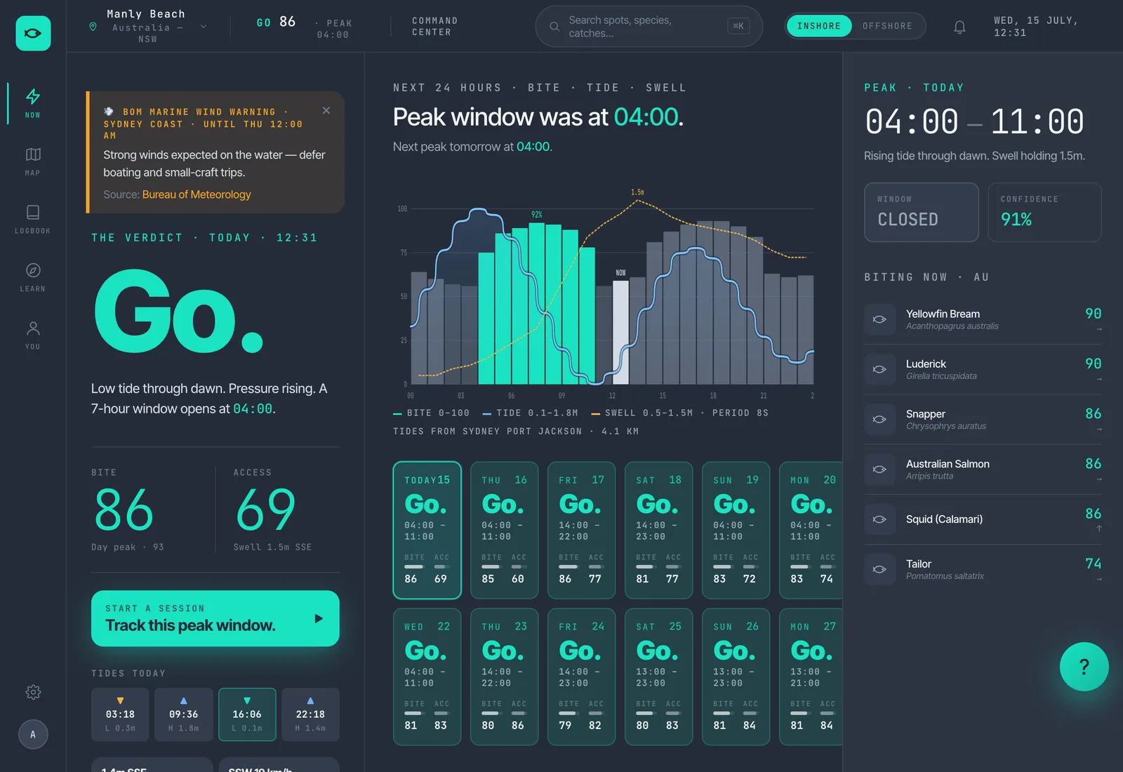
The southerly buster is the recurring pattern that re-shuffles a Sydney week. A 25-35 knot southerly change typically arrives in late afternoon after a hot northerly day, drops water temps a degree or two overnight, and sets up the next two to three days. The bite fires after the buster passes — the air clears, swell drops, water temperature stabilises. Fishing the front edge of the buster from an exposed rock platform is how people end up in the news. Wait for it to pass. The Sydney forecast page shows the 7-day region score plus per-spot detail.
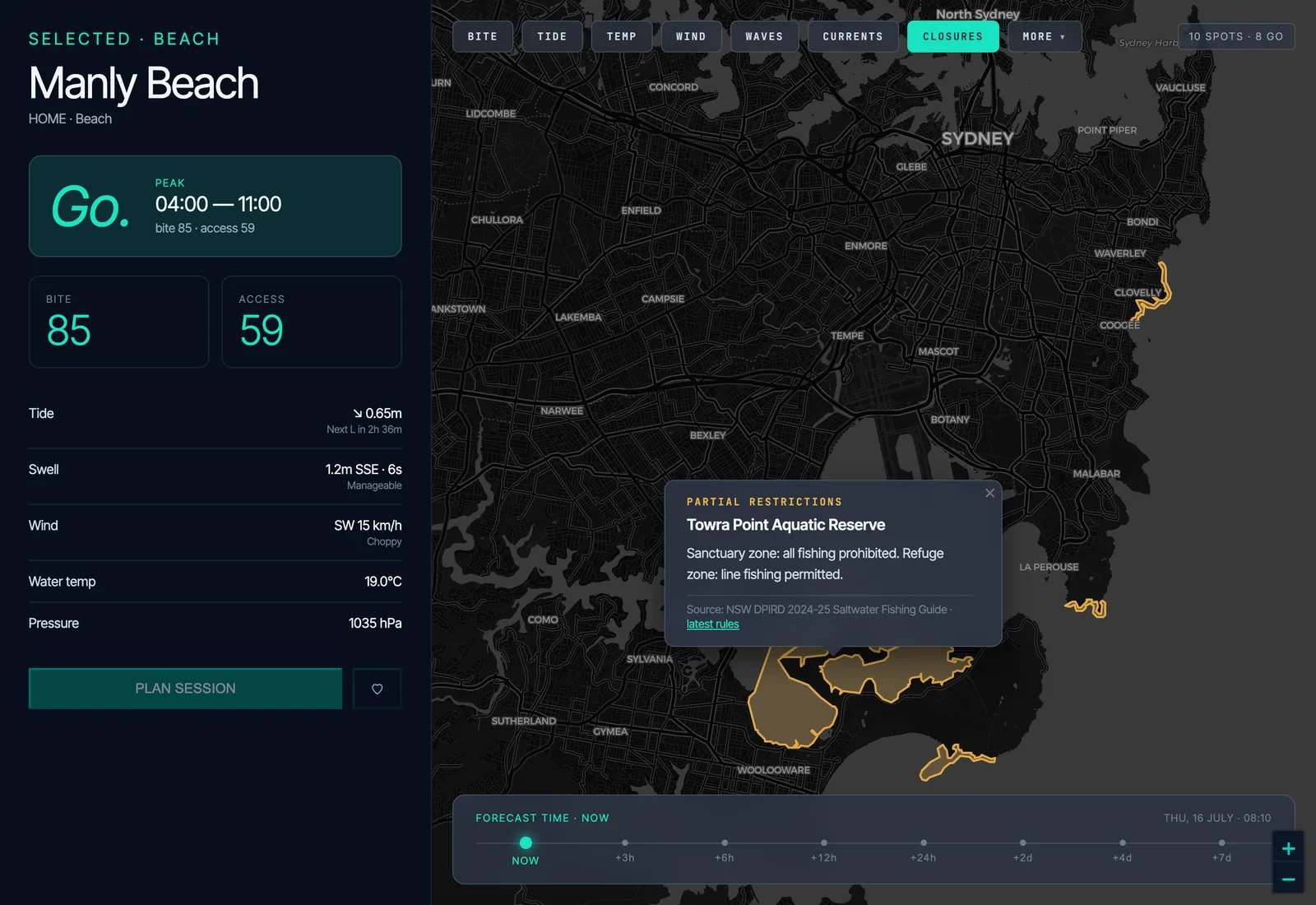
Six overlapping rule sets sit on top of the harbour. The live closures overlay on the Fishare map draws every polygon in real time so you can sanity-check before you cast.
If you're bringing kids — or you just want flat water, parkland, parking and minimum bag-out risk — these are the eight harbour spots where the fishing is good and the safety bar is low.
Lifejackets aren't legally mandatory at any of the spots above — they aren't rock-fishing terrain. They are very strongly recommended for kids on jetties or wharves regardless.
Long before Port Jackson was Port Jackson, the harbour was home to the Gadigal of the southern shores, the Cammeraygal of the north, and the Birrabirragal clan whose Country centred on Sow and Pigs reef. The Australian Museum and Powerhouse Museum both hold collections of fish hooks made from turban shell (Turbo undulatus) — Gadigal and Cammeraygal women fished from nawi (bark canoes) using these hooks on bark-fibre line. Archaeological middens around the foreshore date back over six thousand years. Early colonial records describe Cadigal and Cammeraygal women trading hooks at Sydney Cove in the 1790s. The species sequence — bream, snapper, leatherjacket, mullet, kingfish — has not changed; only the gear, the consumption advice, and the rules around it have.
Watsons Bay had a small commercial seine fishery for tailor, mulloway and Australian salmon through the 19th and early 20th centuries, working the wide flat outside the bay. Commercial netting in the harbour proper was phased out progressively through the 20th century. Modern land-based records inside the harbour are dominated by yellowtail kingfish from the rock platforms at the Heads — metre-plus fish are caught off Hornby Light and the Fairfax-accessible North Head ledges each summer. Specific weights and lengths vary; the NSWSA and ANSA registers are the authoritative source for current land-based records.
The questions readers and members ask most often about this guide.
Open Fishare, pin Sydney Harbour, and the app pings you when the next 3-hour peak window opens at your saved spot. The closures overlay shows every aquatic reserve, dioxin boundary and sanctuary zone mentioned in this guide in real time. Free forever for everyone who joins now.
Open FishareEvery regulatory claim in this guide is traceable to one of the sources below. NSW DPI rules and NPWS closures can change without notice — always check current signage on-site before fishing.
Last verified: 2026-05-19. NSW DPI rules are reviewed annually and the next version of the Saltwater Fishing Guide will be the 2025-26 edition. We'll update this guide when it's published.
These two North Head locations appear in older fishing guides and Instagram tags. Both are now formally closed by NPWS. Don't go there.